
Welcome to the second Monday Maps blog! Last week I featured an example of a topographic map series I produced for my first novel and trilogy. At the time I was writing that trilogy (the late 80s) I was also completing my Ph.D, in which I investigated the social context of mapping. Why, I asked, does western society have the kinds of maps it does?
The answer will surprise no one, though it was fairly revolutionary in the 1980s. Topographic maps are social documents imprinted with colonialist values, both military and economic. They were used to assert the primacy of the physical landscape over any other type of geography, to impose western values on the non-western world, to assess the military potential and limitations of the landscape, and to enhance economic development. They are a conversation between military men and powerful men using cartographers as their translators, and when we read this sort of map we are overhearing a conversation never intended for us. Women are perfectly capable of interpreting maps, but this hyper-masculinist colonialism raises a barrier many do not bother to cross.
How high a barrier can be demonstrated with reference to the words of Col. Thomas H. Holditch, a past president of the Royal Geographical Society, who in 1917 said that:
“The right of the white man to fill the earth and subdue it has always been unquestioned, because it is based on the principle that his [sic] dominance and lordship tend to the betterment of the world.”
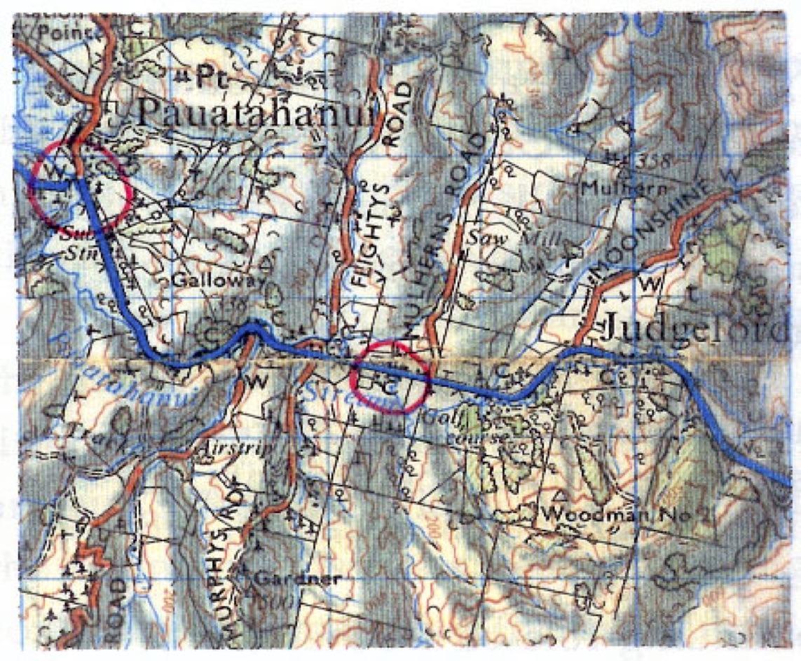
What are the two features marked W and C I’ve circled on this topographic map? Take a moment. (I know I haven’t given you a key.) They’re bridges. One is two-lane, the other is single-lane. What do the letters W and C stand for? Wooden and concrete. So why do we need to know the width and construction of these bridges? Anyone? Because the ability to move ordnance around depends on such knowledge.
The key to understanding topographic maps is to recognise they are military documents. In the UK they are produced by the Ordnance Survey. Historically the chief surveyor had a rank in the military, often the surveyor-general.
Topographic maps are used as the base maps for most other mapping types. Humanity has spent millions of hours and billions of dollars making them. They have, unsubtly, remade the way we see reality. The central challenge of my academic career was to try to imagine what sort of maps we’d have – and what sort of societies we’d have – if westerners had gone with human-centered rather than empirical knowledge as their philosophical foundation… which is where fantasy maps come in. Or they should do. But that’s for another post.

Leave a comment