
Let’s have a look at another map from Silent Sorrow, my upcoming novel, and in doing so I’ll approach the cartographic problem in an “as it happened” way.
Some background first. The novel has three groups of characters. So far we’ve seen maps from the actual cartographers: Remezov, Felicev, Estilia and Esmer. The second group of characters centre around Spit and Polish, a brother and sister, 12 and 11 years old respectively. (Their real names are Charal and Tercelle.) Their story begins in a different part of the continent.
So I need a map that does at least three things. First, it needs to show the area their action takes place in: let’s call that a reference map. Second, the map needs to be linked to the plot, which I can most easily achieve using thematic data (what the map is about). And third, it should bear something of the personality of its maker, in this case Spit, the elder of the siblings.
The first requirement tells me the extent of the map. Spit’s story arc covers the northern third of the continent, so it needs to be a small-scale map. (Small scale maps cover large areas.)
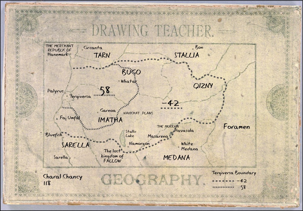
The second requirement is much trickier. I can’t drop in spoilers, but maps aren’t that necessary to them for much of their arc. What is important is that Spit and Polish share a hatred of their tutor, and I think I can show that by making a variant of a rather obscure map form: the Drawing Teacher.
A Drawing Teacher is a partly completed outline of a picture or map given to a student, who is asked to complete it. They were popular in the eighteenth and nineteenth centuries, but in my secondary world, with its fixation on geography, I can project that back a few hundred years.
The beauty of using a Drawing Teacher is I can show something of Spit’s personality in the script I use to mimic his writing. Disengaged, sullen and petulant. Finding a font that echoes those traits might be tricky, and I’m not sure I’ve found one yet. I can also use it to teach Spit – and the reader – something about the area’s history. We learn that Tergiversa, the curiously-named city they live in (look it up for a tiny clue), is a small remnant of a much larger country, and this is what the Drawing Teacher asks Spit to map. This, and the fact that Tergiversa is a mercenary city, is germane to the plot.
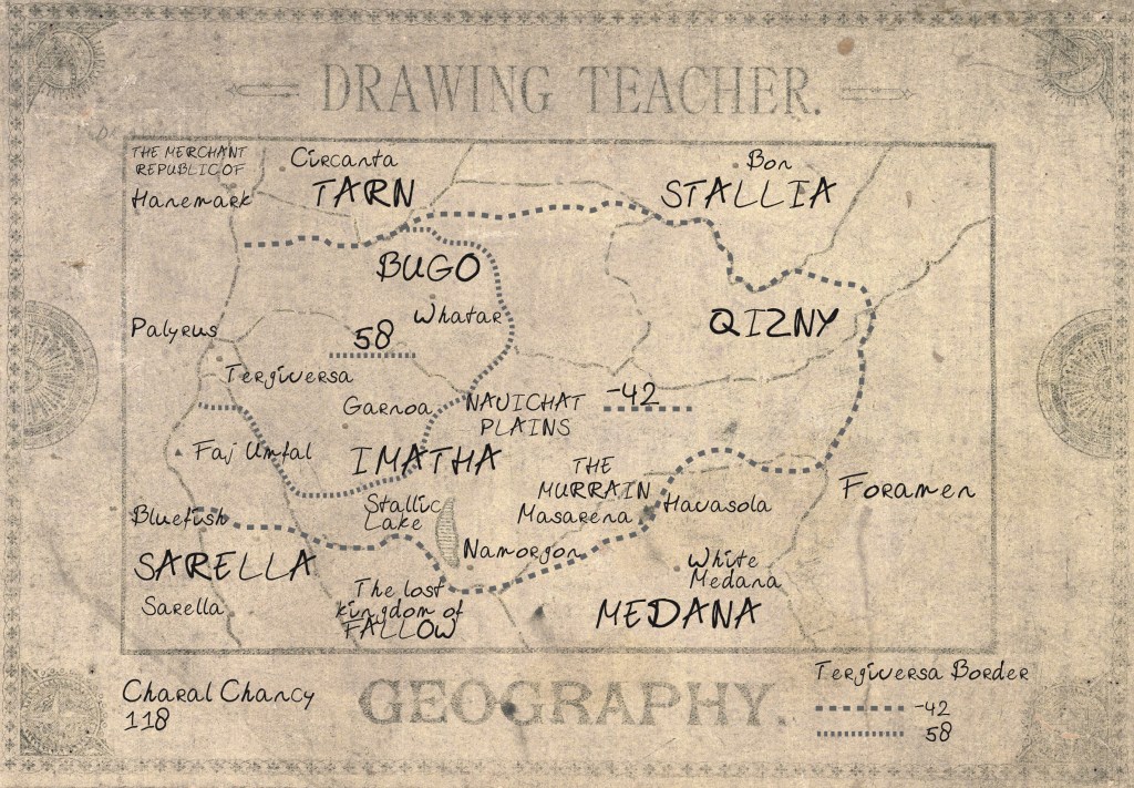
The current version of the map is an interesting and not quite successful compromise between the three requirements, with the slovenly font and the hard-to-read outlines rendering the map less readable than I’d like. I’ve included two versions, along with the instructions accompanying the Teacher, with the only difference between the two being the font Spit uses. Which works better? I’d be interested in your comments!

Leave a comment