Welcome! I am a writer, a cartographer and a photographer. With six best-selling fantasy novels and a similar number of award-winning atlases, I am sure I can entertain you. There’ll be something new every week, so remember to check back often.
Blog Feed
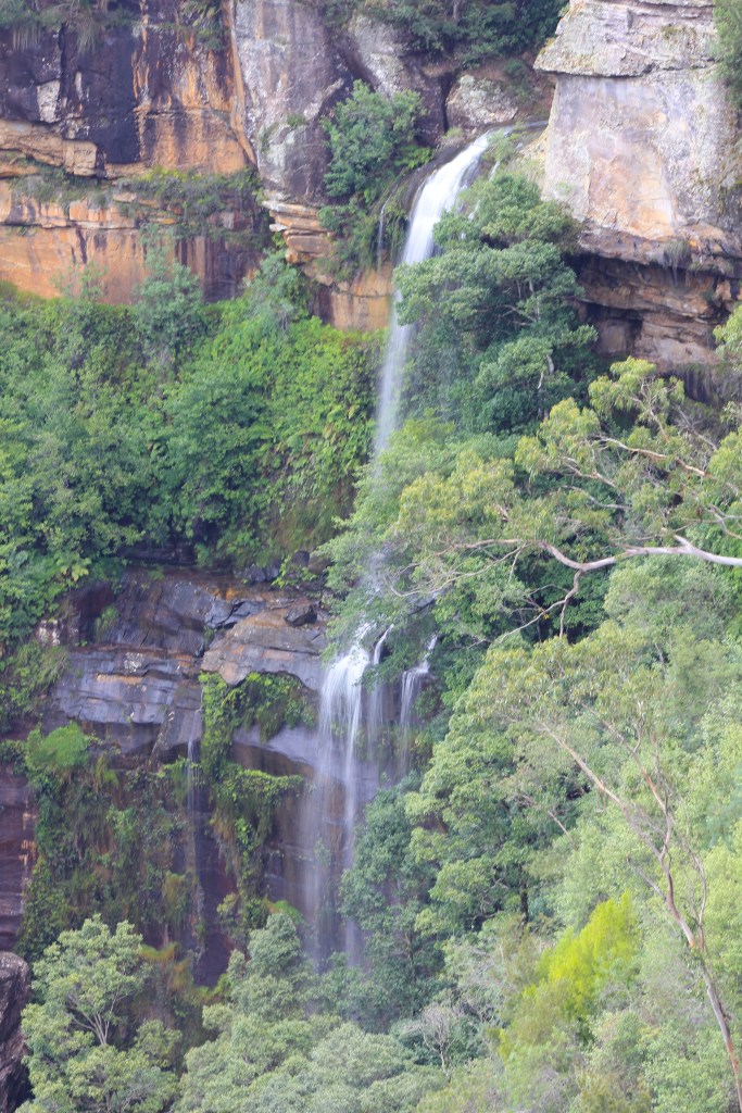
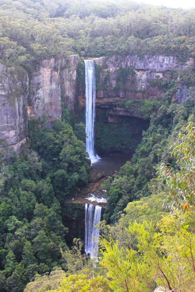
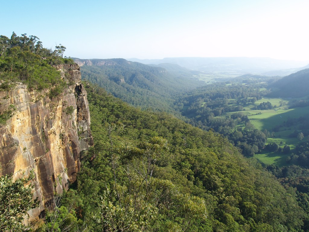
Wentworth Falls and Govetts Leap

Today on Waterfall Weekend I chronicle my failure to get any great photos on a weekend visit to the Blue Mountains. For that I blame the weather and my lack of practice.
We’ve had two years of drought, a season of bushfires and flooding rains. It rained so hard in the Blue Mountains many of the tracks were washed away, so access to much of the region was limited. Still, I had high hopes when I left Canberra with Kylie early Saturday morning.
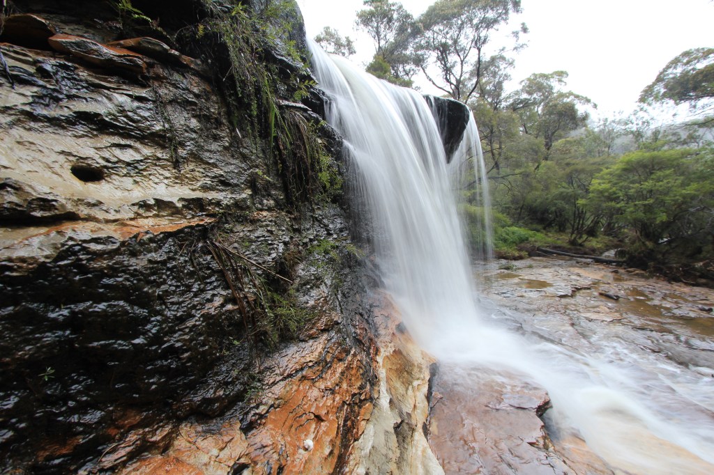
Not so high when we arrived at Wentworth Falls. In fact all Saturday was a bust, with mist and rain making it impossible to see the waterfalls, let alone photograph them.
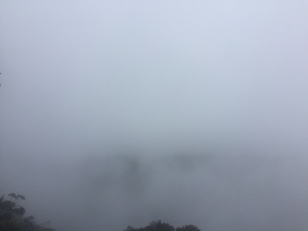
I managed to find a lookout from where I could see something, then tried to use the mist, water and rock to create texture. Quite pleased with the results.
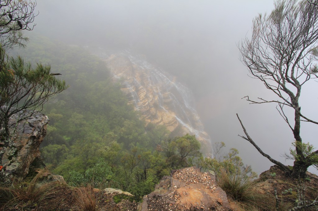
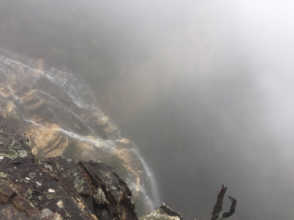
I spent the rest of my short time there photographing Weeping Rock, a small fall above Wentworth Falls. Again I was searching for textural contrast here.
Sunday looked more promising but I chose the wrong side of the mountains: the northerly pushed the remaining mist against the northern wall of the plateau, obscuring Govetts Leap and Bridal Veil Falls.
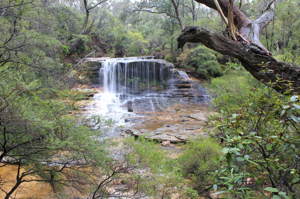
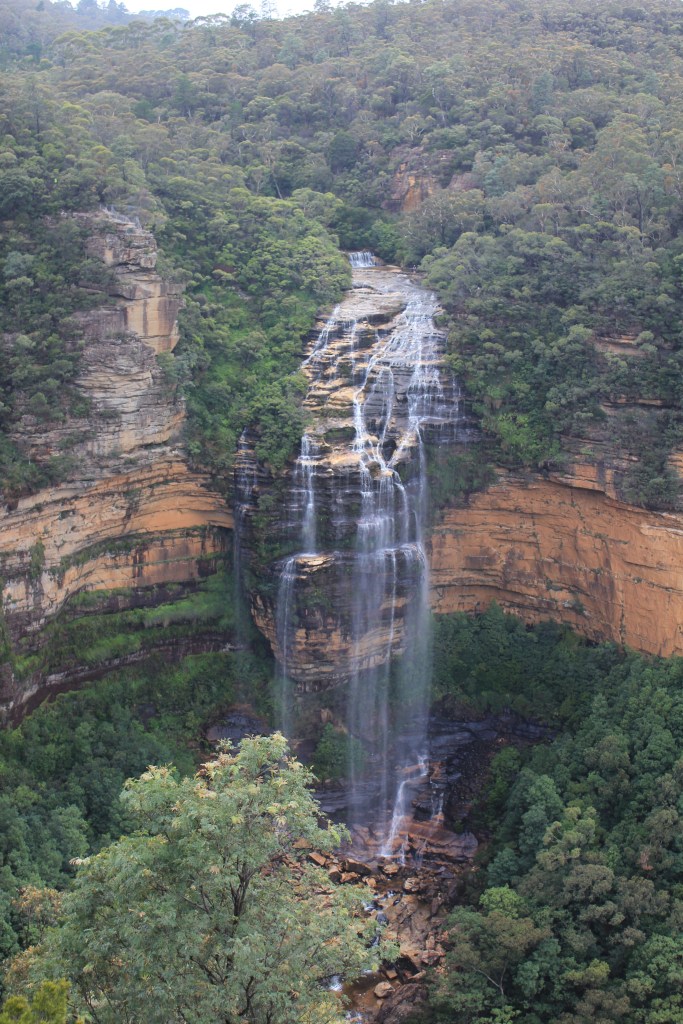
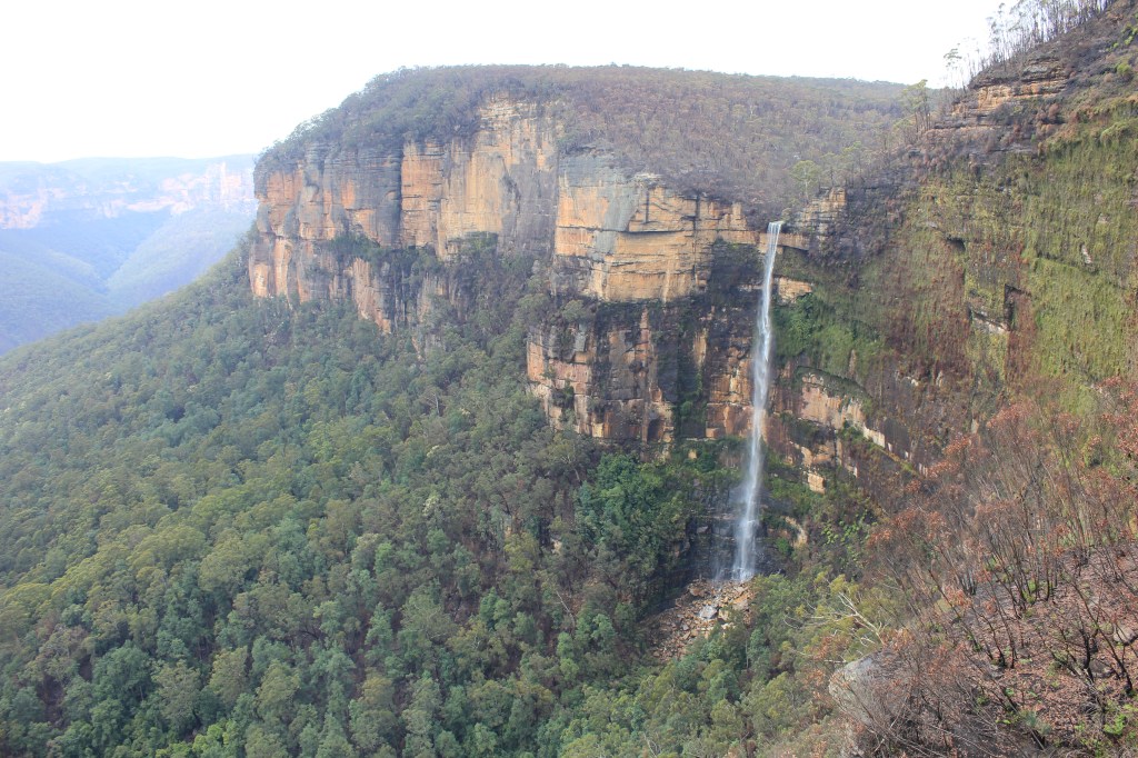
So I charged back across the plateau to Wentworth Falls, which by now was much clearer.
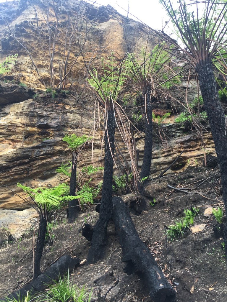
Inspired by my change in fortune I scoffed a quick breakfast, then went back to Govetts Leap. The fire damage was clear, but recovery was already underway under the canopy, and the waterfall still had plenty of water in it.
No new waterfalls visited, no great photos, but after two years it was nice just to have the Canon back in my hand. We’re going back, oh yes, and we’ll capture a number of falls we haven’t yet seen.
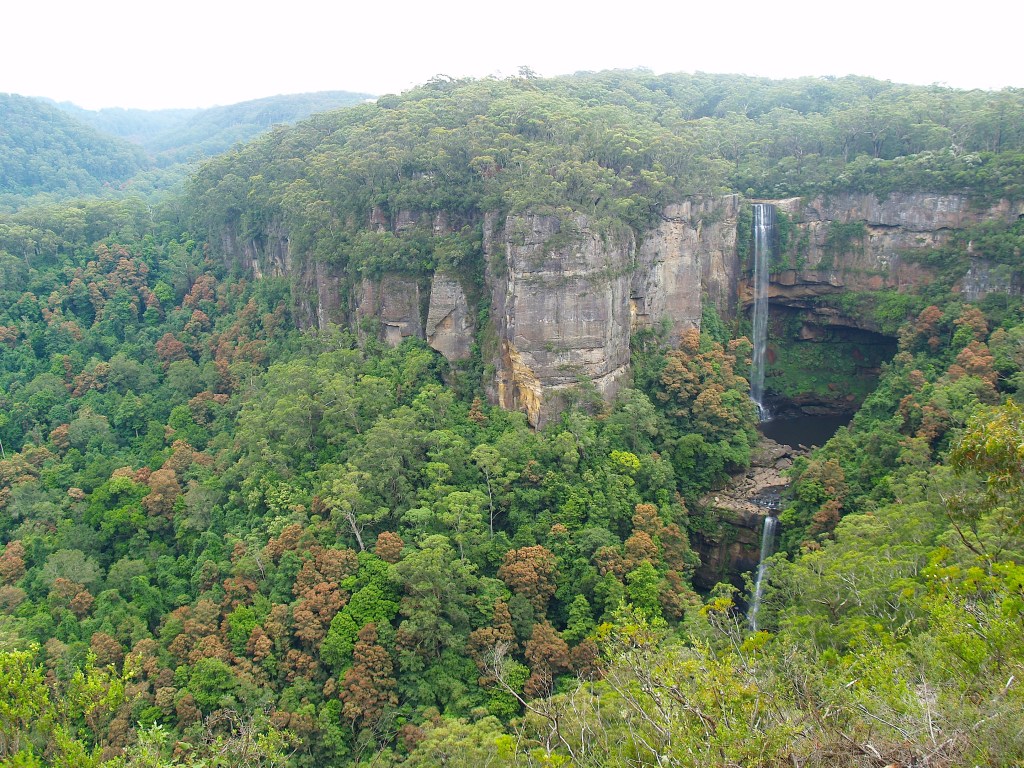
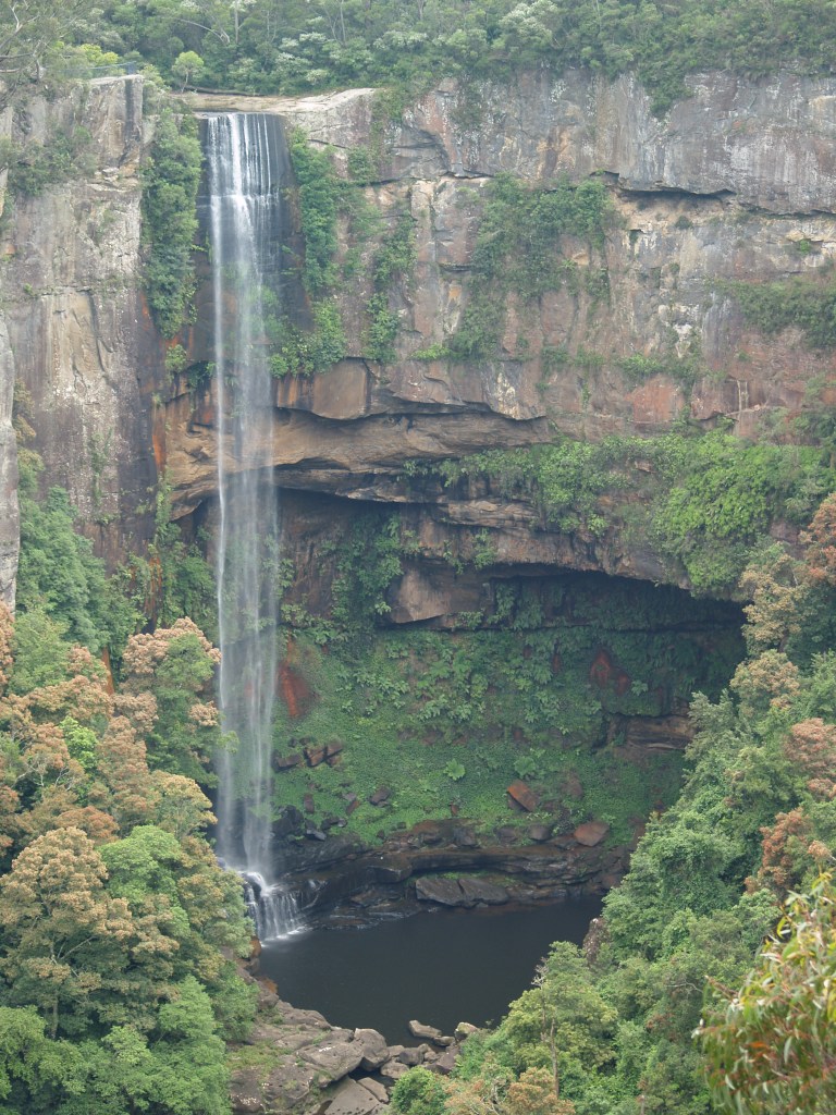
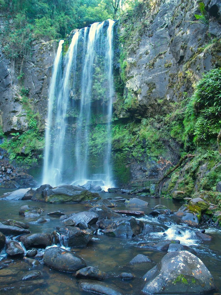
Fitzroy Falls

The 2019/20 Neoliberal bushfires have burned a significant percentage of south-eastern Australia. Many of the beautiful escarpment waterfalls will have been affected. Though it doesn’t compare to the extensive loss of animal and human life, losing our beautiful places still hurts.
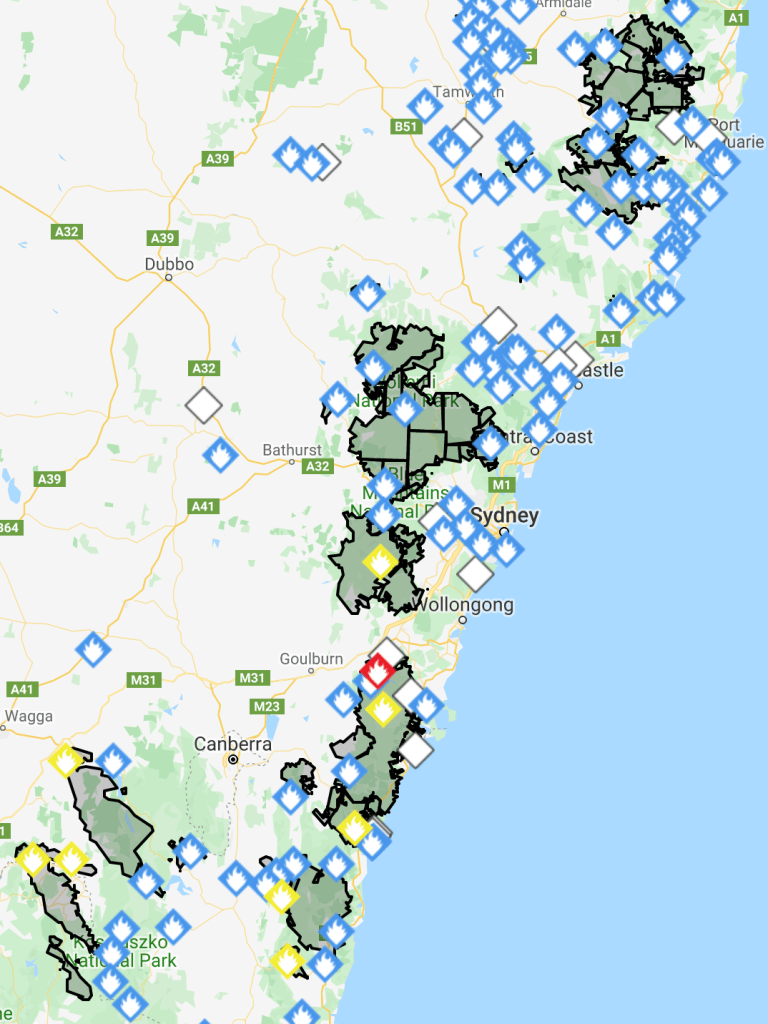
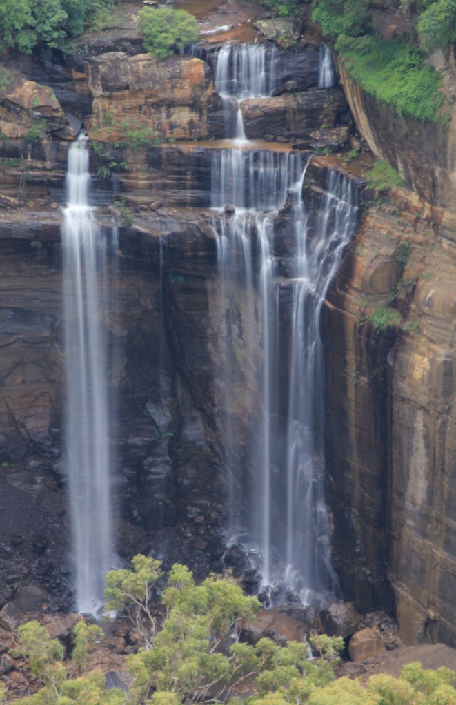
As of last night the new Morton fire (the single red diamond on the map above) was a scant two kilometres from Fitzroy Falls, the jewel in the Southern Highlands’ crown. It may well have been burned, and the lovely visitor centre lost, as I’m typing this. So I thought I’d give you a tour of the falls so you can see what’s at risk.
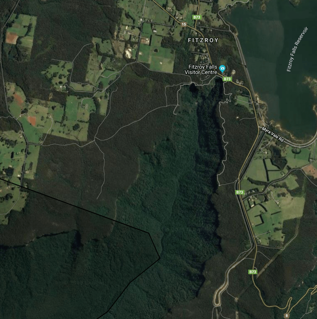
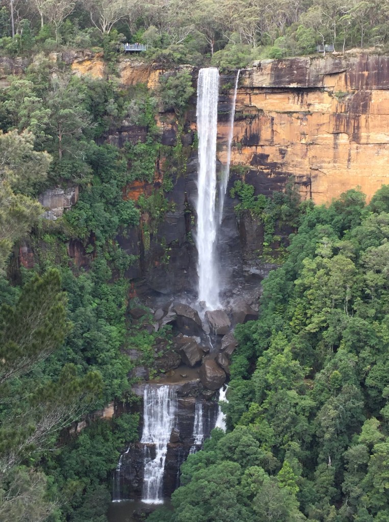
Fitzroy Falls is the most well known of the Southern Highlands waterfalls as it is literally 50m from one of the highways from the coast to the interior of eastern Australia. You park your car, pay a small fee, and two minutes later you stand on a platform directly above the waterfall and look out over the valley (and look down if you’re brave). 90% of tourists satisfy themselves with this view, but there are better.
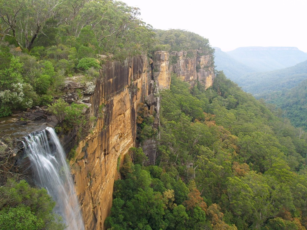
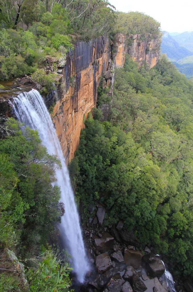
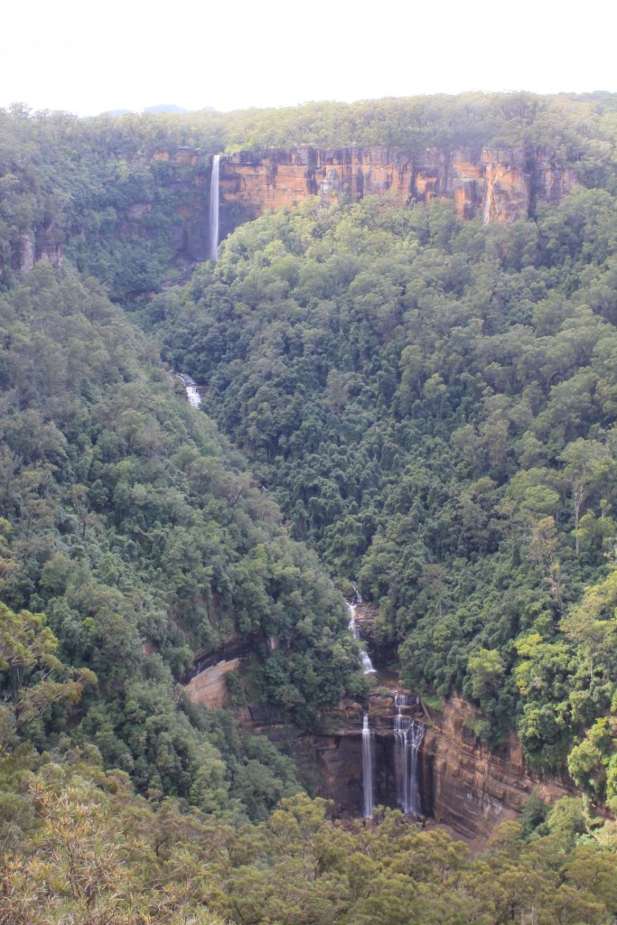
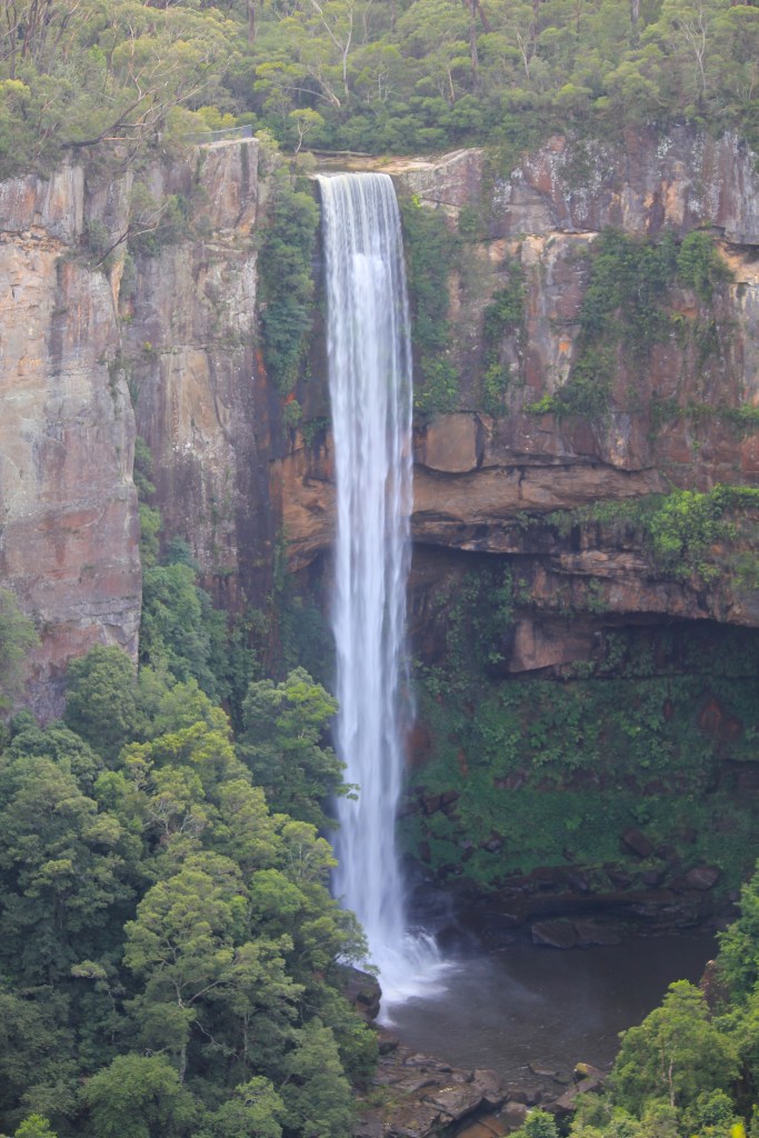
A track winds its way west and south along the top of the escarpment, and 800m further on you are given a much better view of the main fall. Of those who get to this point, most go no further, and neither should you – unless there’s been recent substantial rain. In that case, continue, as there are four more waterfalls to see.
The first two are Twin Falls, and I’ve only seen them running once out of the twenty or so times I’ve visited the area. There’s something fascinating about a rarely flowing fall: will it or won’t it be flowing? What will it look like? I thought them beautiful.
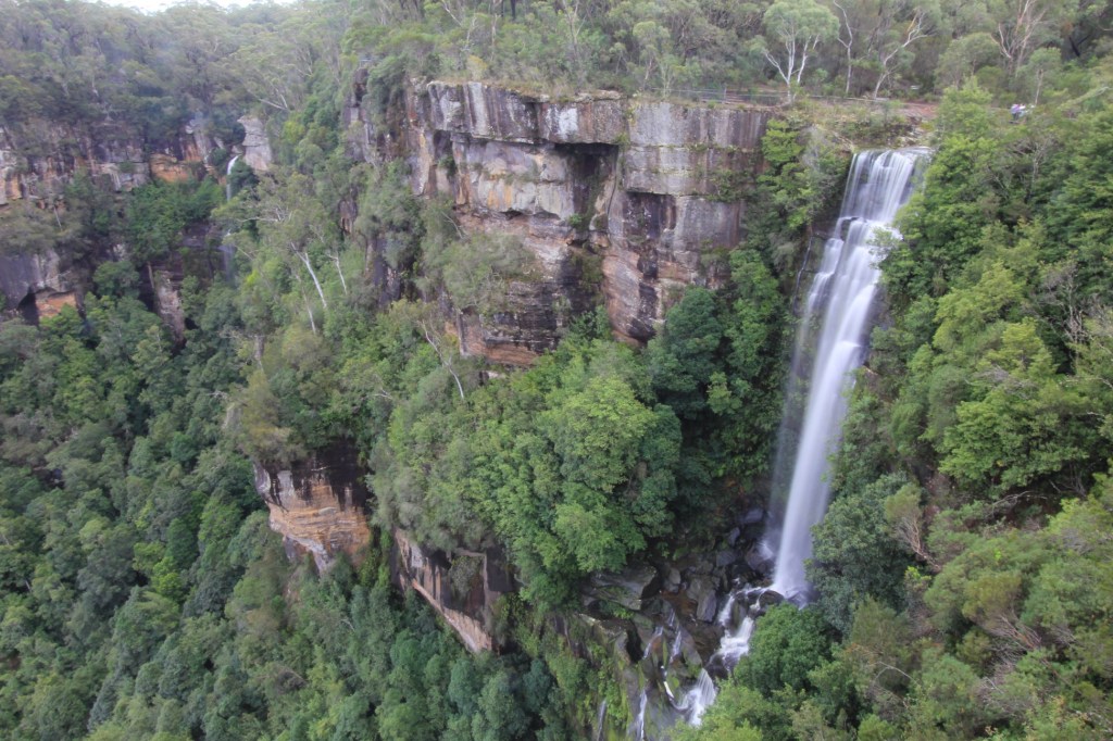
A very small waterfall is accessed from just below the track. Beyond this the track continues to the final viewpoint, which gives an excellent, if distant, view of Lady Hordern Falls, which looks better through a telephoto lens than it does in real life.
A note: all of eastern Australia is affected by a prolonged drought. Though water is drawn from the headwaters of this river for Hydro and irrigation, the dam does ensure a minimum flow in all but the worst conditions. However, these waterfalls are definitely best viewed after rain.
And unburnt.
Rawfoot’s Map

Here’s another map from – you guessed it – my upcoming novel, Silent Sorrow (to be inflicted on you mid-2020). I can’t say much about it as it would give away too much of the plot.
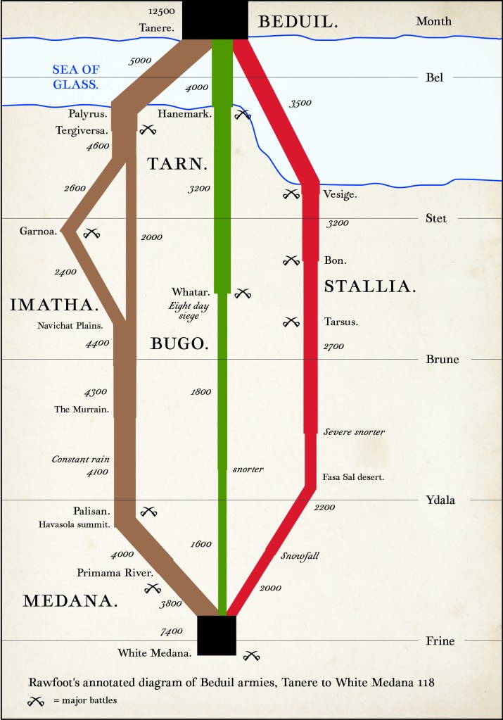
What I can say is: five points to those who, without googling, can tell me what this graphic is showing, what famous graphic it is based on and who drew the famous graphic (double bonus points for the last one*).
I can also say that the imaginary cartographer of this map is a POV character who ended up being edited out of Silent Sorrow to appear instead in the sequel. Rawfoot is a very interesting person indeed and an extremely reluctant cartographer – actually, an extremely reluctant everything.
For those new to this game, my goal in integrating maps into this novel is to find innovative ways of presenting both plot and character in the maps and graphics. This map shows a certain minimalism, a tightness and smallness of character, a prissiness in fact, in the efficiency the information is presented, the choice of font and his pedantic habit of putting a full stop/period after every place name.
One interesting question: once you’ve worked out in which direction the flow is going, should the map be oriented with Tanere at the top or White Medana? It depends, in my opinion, who the map is made for: the Beduil or the Medanans. Are the armies coming towards you as a growing threat or are you part of the army, heading towards a distant stronghold? One of my pet cartographic hates is the automatic assumption that north will be at the top. In this case, like in many others, orientation depends on your relationship to the data. (And even the term ‘orientation’ refers to the practice of turning a map to place east (the Orient / Paradise) at the top in the later Middle Ages for religious reasons. Bet you didn’t know that one.) https://en.wikipedia.org/wiki/Map#Orientation_of_maps
I admit to being interested as to whether people can actually work anything out about the plot from this map. Probably nothing beyond the obvious, I’m betting.
A Page from a Bestiary

Something quick and dirty from the upcoming novel (which, as I’m constantly reminding you, is entitled Silent Sorrow and is being published mid next year by IFWG). It’s a page from an illustrated bestiary one of my protagonists stole from a library.
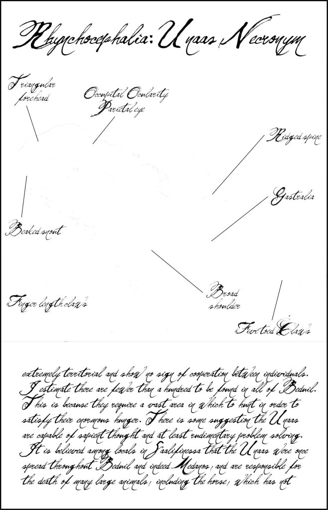
What’s odd about it is that the animal being illustrated seems to have… faded. Remembering that all the maps and diagrams from this novel are artefacts of the world, and all carry part of the plot, I can’t say any more than that. Suffice it to say that this is not the only time scientists trying to describe this elusive beast have come up with a blank.
I wanted this to be hard to read, and I think I succeeded. The font is intended be forbidding, as this knowledge, according to the author, is not for everyone. Academics are by no means immune from playing these sorts of games. I’ve read plenty of academic articles where it seems the arguments have been couched in terms designed to admit only the worthy – and, by doing so, place their concepts out of reach of the uninitiated. Some will remember the Sokal controversy of the late 1990s, a rather unfair dig at deconstructivism. I’m trying to say something about what happens to science, and particularly the communication of science, in an inevitably politicised world. (It turns out we’ve met the author of this article earlier in the novel.)
I drew an earlier version of this with the beast visible, and it was much less effective. “Hide the monster as long as you can” is still good advice!
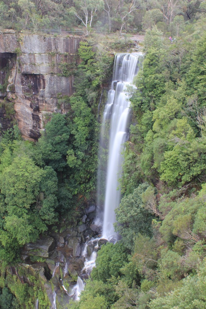
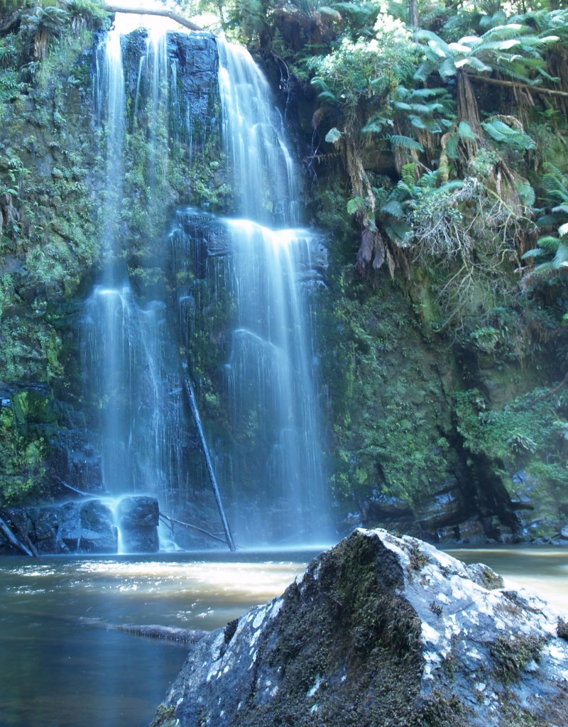
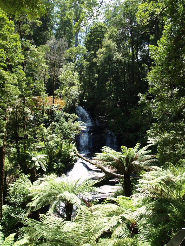
Belmore Falls

I seem to have been sidetracked from my intention to show you the major waterfalls of Australia’s eastern escarpment. We went off to the Otways last week. Focus, Russell. Back to the Southern Highlands we go for the next couple of weeks. This week: the two-tier Belmore Falls.
The first item of interest is getting there. The more sensible method is to drive south from Robertson, a small town in the Southern Highlands on the Illawarra Highway. However, if you’ve just visited the more famous Fitzroy Falls, you may be tempted to drive straight to Belmore Falls along Myra Vale Road and then Belmore Falls Road. Only problem with that is the road fords the stream directly above the falls, and is sometimes closed due to flooding. I admit to struggling across the ford in my little MX-5.
When you finally get there you’ll discover that this is a lovely waterfall. It’s significant in terms of height, though volumes are usually low. There are two viewing platforms, both at the height of the head of the falls, so unfortunately you don’t get to see it from below. At the end of the access road there’s also a third viewpoint, this looking south-east over Kangaroo Valley, and with the right evening light it’s spectacular.
Each of the two main drops make an excellent photographic study, and together Belmore Falls is well worth the effort. It’s best combined with a visit to Carrington Falls (featured a few months ago) and Fitzroy Falls (to be featured next week). The three falls make an excellent half-day trip.
Muta Valley

This is a map I’ve just finished drawing for my upcoming novel, Silent Sorrow (IFWG, May 2020), which is now with the editor.
Muta Valley is a map drawn years ago by a child (albeit a precocious child) of his home environment. Normally the map of the bucolic home valley comes at the beginning of a quest fantasy, but in Silent Sorrow the protagonist does the journey in reverse, forced to travel back to his hated childhood as everything is stripped from him.
He returns to his abandoned homestead and rediscovers his first cartographic work. As he studies the map content he realises that the narrative he’s fashioned for himself of being driven out of the valley because no one understood him might be somewhat self-serving. It’s possible some of the blame might be his.
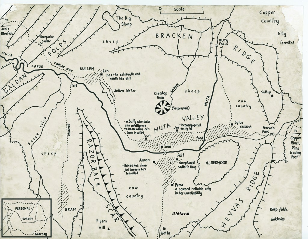
This is another example of map as artefact. It contains essential plot and character information, dovetailing with the narrative. The form of the map is just as important as the content: I worked hard with the typography to suggest a young child pushing himself to the limit of his fine motor skills in his quest to understand his environment.
The nearest academic equivalent to this sort of map is the Mental Map tradition of the 1970s and 80s, where it was established that people who are asked to draw a freeform map exaggerate the size and importance of their home area. I do hope Remezov realises this and doesn’t rely on it for navigational purposes…
* It’s Tuesday here in Australia but maybe Monday where you are so I win.
The Otways

Kylie and I went to Melbourne’s Big Day Out in 2010 (The Decemberists! Mastodon! The Mars Volta! Muse!) and afterwards did the Great Ocean Road. Yeah, we saw (and flew over in a helicopter) the Twelve Apostles, but we also got to a few of the waterfalls in the Otway Ranges.
Thing is, the light was terrible the entire trip. (Note to self: blame the light.) I didn’t get one single great photograph. So here are a few of the better ones.
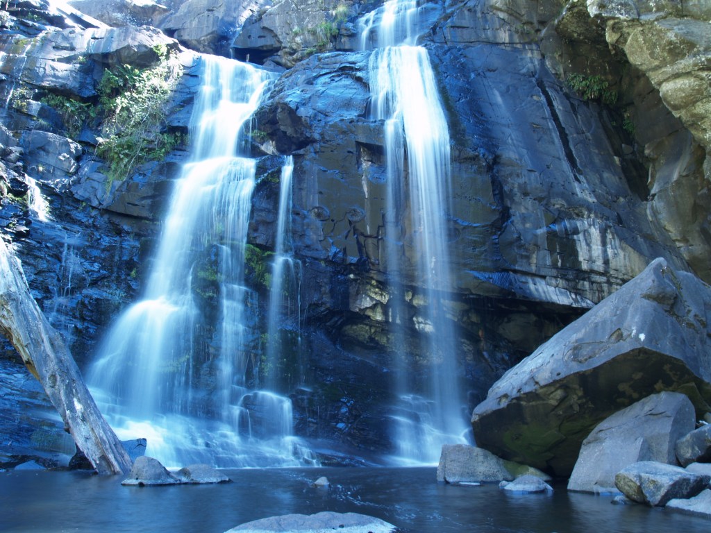
There’s no magic formula to make extreme contrast disappear. Better photographers than me could make more of these opportunities, but I was at a loss. Rule number 1: get the light right. To achieve that, stay in the area long enough to visit the fall in a variety of conditions.
I’ve seen some great photographs of these waterfalls, especially Triplett Falls, and hopefully I’ll get back there some day.
Chandalar’s Wall

Not a map, but still a diagram-like object so I’m going to count it. This is another example of map-as-artefact from the upcoming novel Silent Sorrow. It’s rather standard in execution, but I use it to pin some earthquake-related worldbuilding to and also to anchor a major plot point. Can’t tell you what because of spoilers.
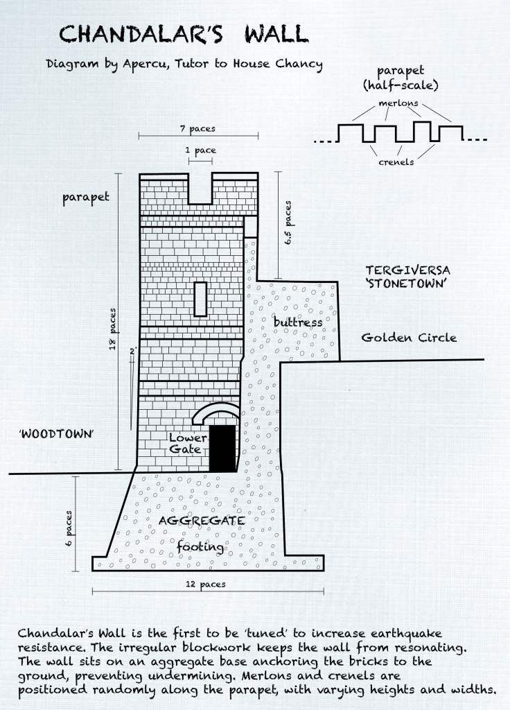
Like the Drawing Teacher I featured last week, this is drawn by Dr. Apercu, Spit and Polish’s tutor. It’s pen on heavy parchment, designed to be taken out into the field (so the children can go to the wall and use it to identify important features).
I’ve shown you less than half the maps in the book but I don’t think I can show you any more, as they are too spoilery.
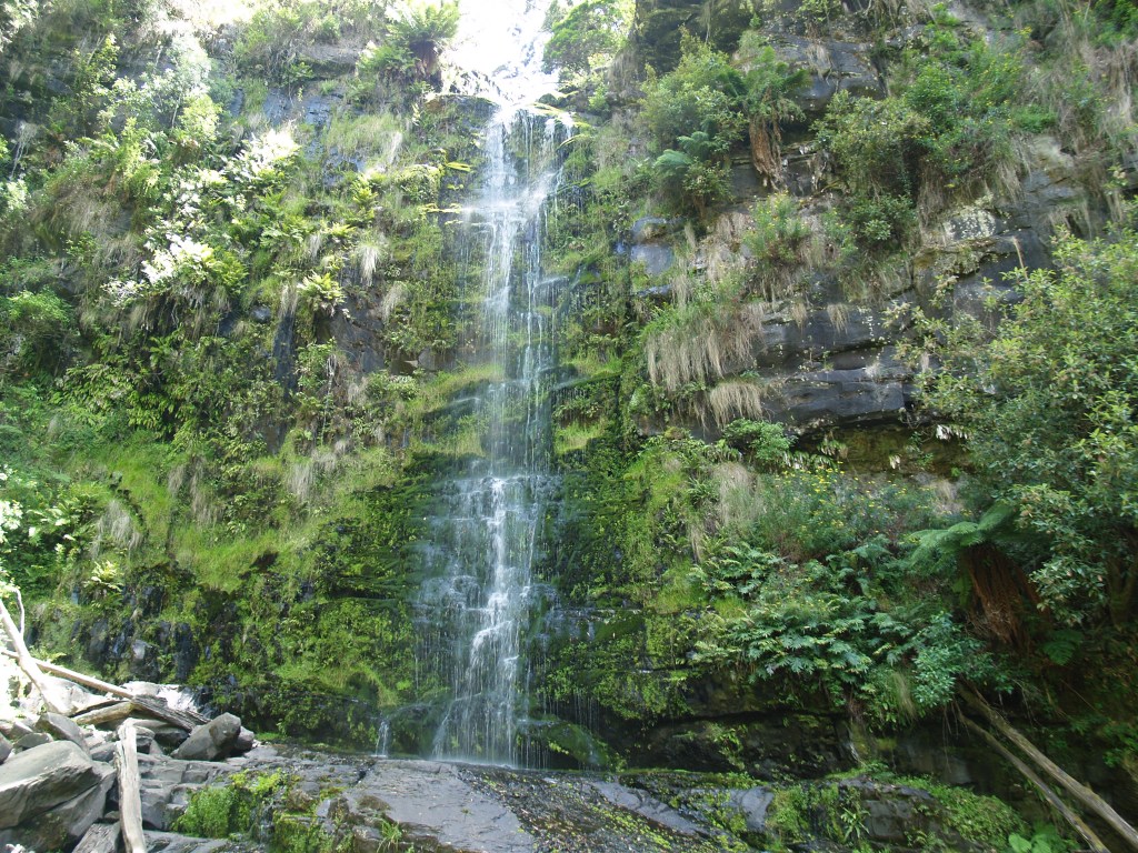
Gibraltar Falls

There’s not much to the Australian Capital Territory (ACT). It’s one city of 400,000 people and a smallish hinterland, enough for a water and timber resource for the territory when it was established a hundred years ago. The ACT exists because neither Sydney nor Melbourne wanted the other to be Australia’s capital city, so Canberra ended up being the compromise, and it needed its own political autonomy.
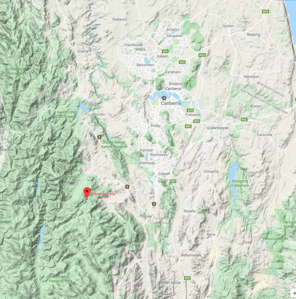
Come on Russell, this is supposed to be about waterfalls. I said all that because I wanted to say the ACT only has one waterfall of note. Gibraltar Falls is about half an hour south of central Canberra, a decent enough waterfall in the foothills of the Brindabella Range. I’m not sure if it’s a permanent feature, but I’ve never not seen it flowing cheerfully and with rather more energy than you’d expect for a little Aussie waterfall.

It’s neither symmetrical not pretty, but it’s at least interesting and an enjoyable two-hour excursion from Canberra. I’d guess it to be about 30-40 metres tall, and unfortunately it’s difficult to get to the base without fording the stream a few times. There’s a well-maintained walk from the car park to the viewing platforms about halfway down the falls, and excellent pools to cool off in above the falls. Because of the limited viewpoints, most photos of the waterfall look similar. I took a few wide-angle shots and stitched them together to give as full a view of the falls as it’s possible to get from the lower viewpoint.
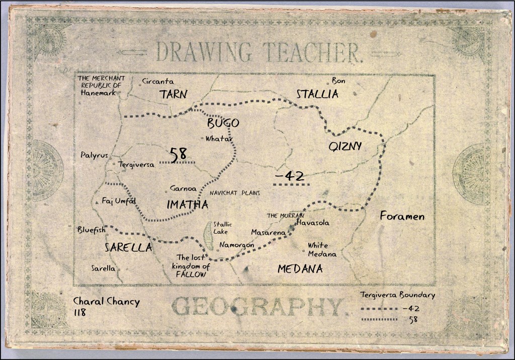
Drawing Teacher

Let’s have a look at another map from Silent Sorrow, my upcoming novel, and in doing so I’ll approach the cartographic problem in an “as it happened” way.
Some background first. The novel has three groups of characters. So far we’ve seen maps from the actual cartographers: Remezov, Felicev, Estilia and Esmer. The second group of characters centre around Spit and Polish, a brother and sister, 12 and 11 years old respectively. (Their real names are Charal and Tercelle.) Their story begins in a different part of the continent.
So I need a map that does at least three things. First, it needs to show the area their action takes place in: let’s call that a reference map. Second, the map needs to be linked to the plot, which I can most easily achieve using thematic data (what the map is about). And third, it should bear something of the personality of its maker, in this case Spit, the elder of the siblings.
The first requirement tells me the extent of the map. Spit’s story arc covers the northern third of the continent, so it needs to be a small-scale map. (Small scale maps cover large areas.)
The second requirement is much trickier. I can’t drop in spoilers, but maps aren’t that necessary to them for much of their arc. What is important is that Spit and Polish share a hatred of their tutor, and I think I can show that by making a variant of a rather obscure map form: the Drawing Teacher.
A Drawing Teacher is a partly completed outline of a picture or map given to a student, who is asked to complete it. They were popular in the eighteenth and nineteenth centuries, but in my secondary world, with its fixation on geography, I can project that back a few hundred years.
The beauty of using a Drawing Teacher is I can show something of Spit’s personality in the script I use to mimic his writing. Disengaged, sullen and petulant. Finding a font that echoes those traits might be tricky, and I’m not sure I’ve found one yet. I can also use it to teach Spit – and the reader – something about the area’s history. We learn that Tergiversa, the curiously-named city they live in (look it up for a tiny clue), is a small remnant of a much larger country, and this is what the Drawing Teacher asks Spit to map. This, and the fact that Tergiversa is a mercenary city, is germane to the plot.
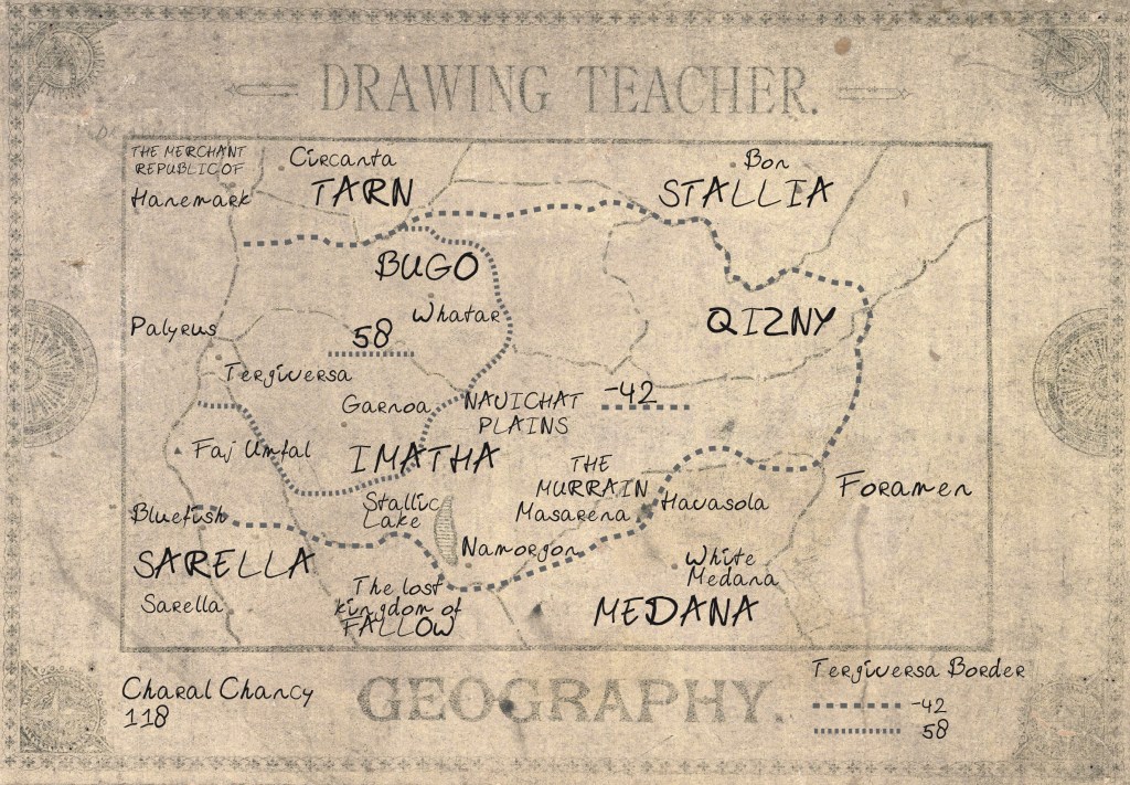
The current version of the map is an interesting and not quite successful compromise between the three requirements, with the slovenly font and the hard-to-read outlines rendering the map less readable than I’d like. I’ve included two versions, along with the instructions accompanying the Teacher, with the only difference between the two being the font Spit uses. Which works better? I’d be interested in your comments!